
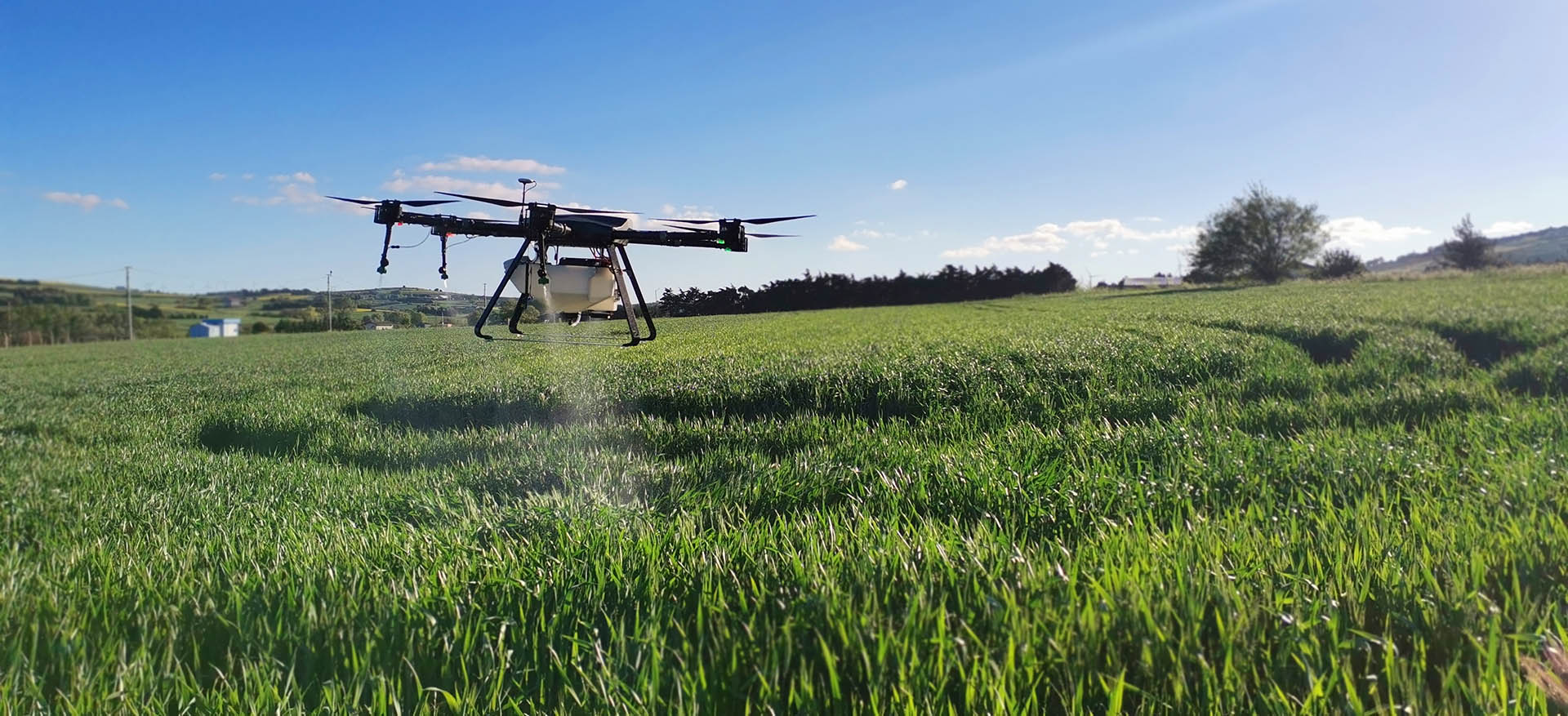
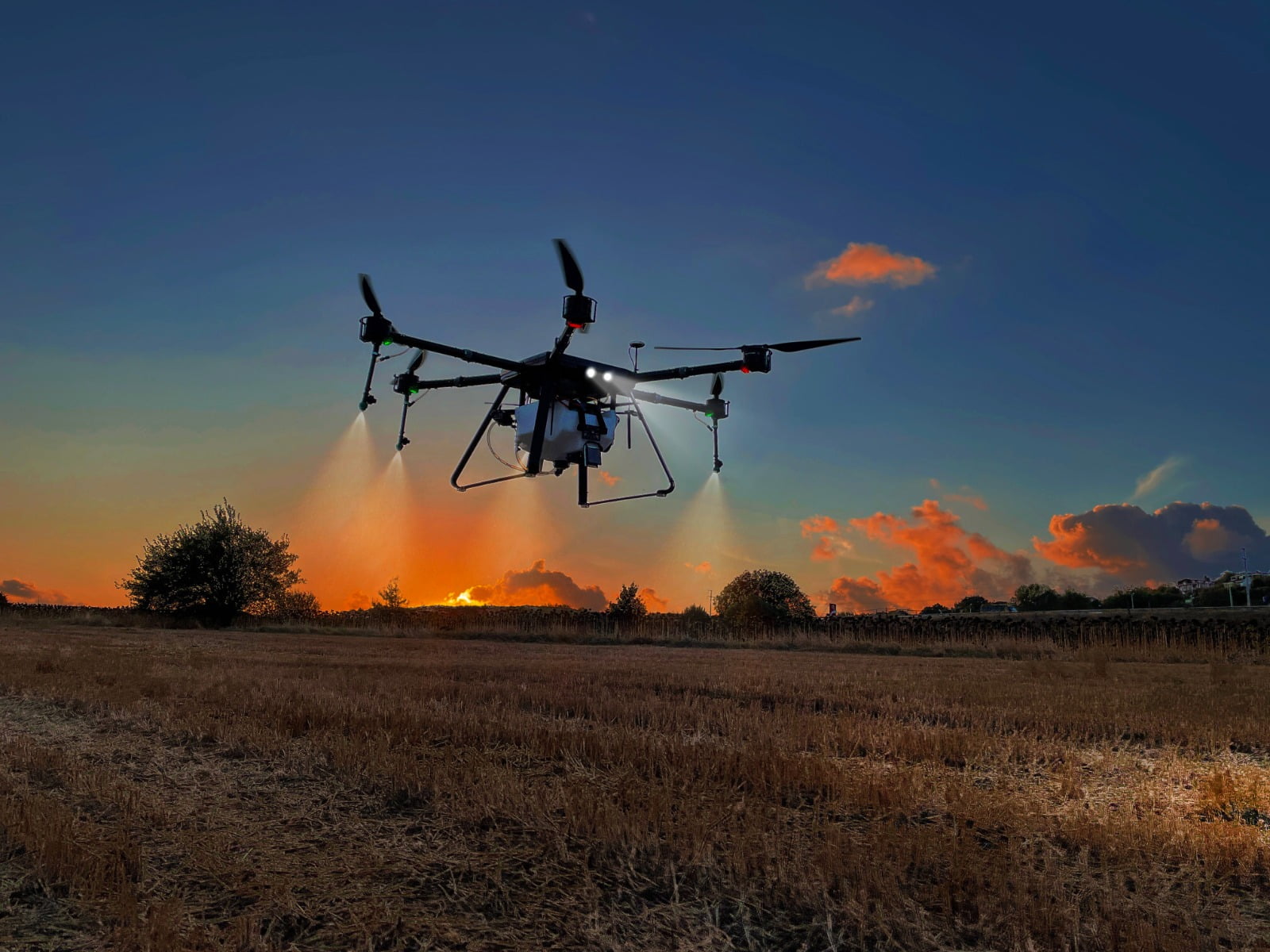

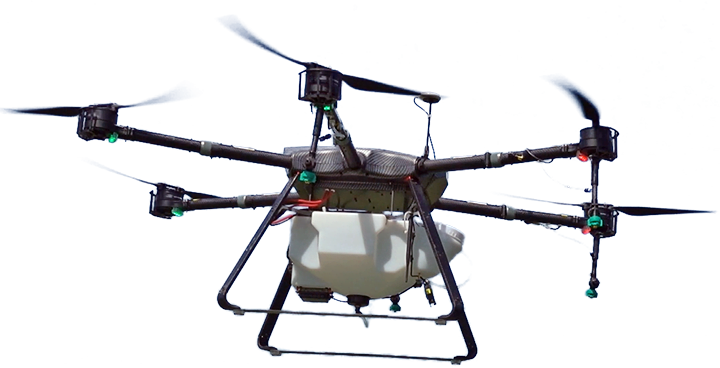

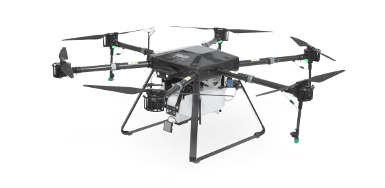
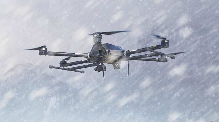
Gelişmiş Zirai Drone
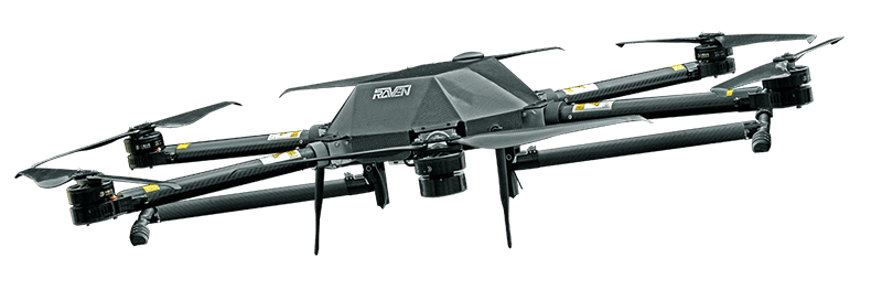
RAVEN TAR SERİSİ
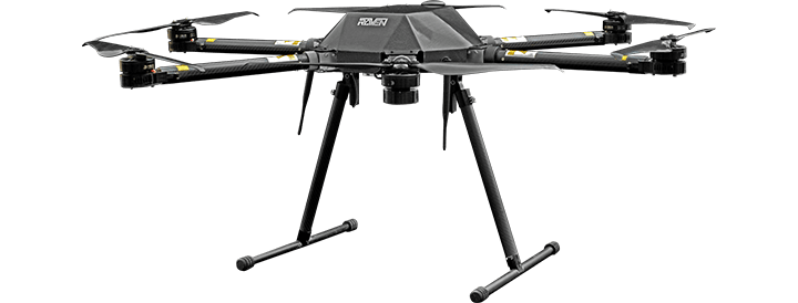
Çok Amaçlı Faydalı Yük Taşıma
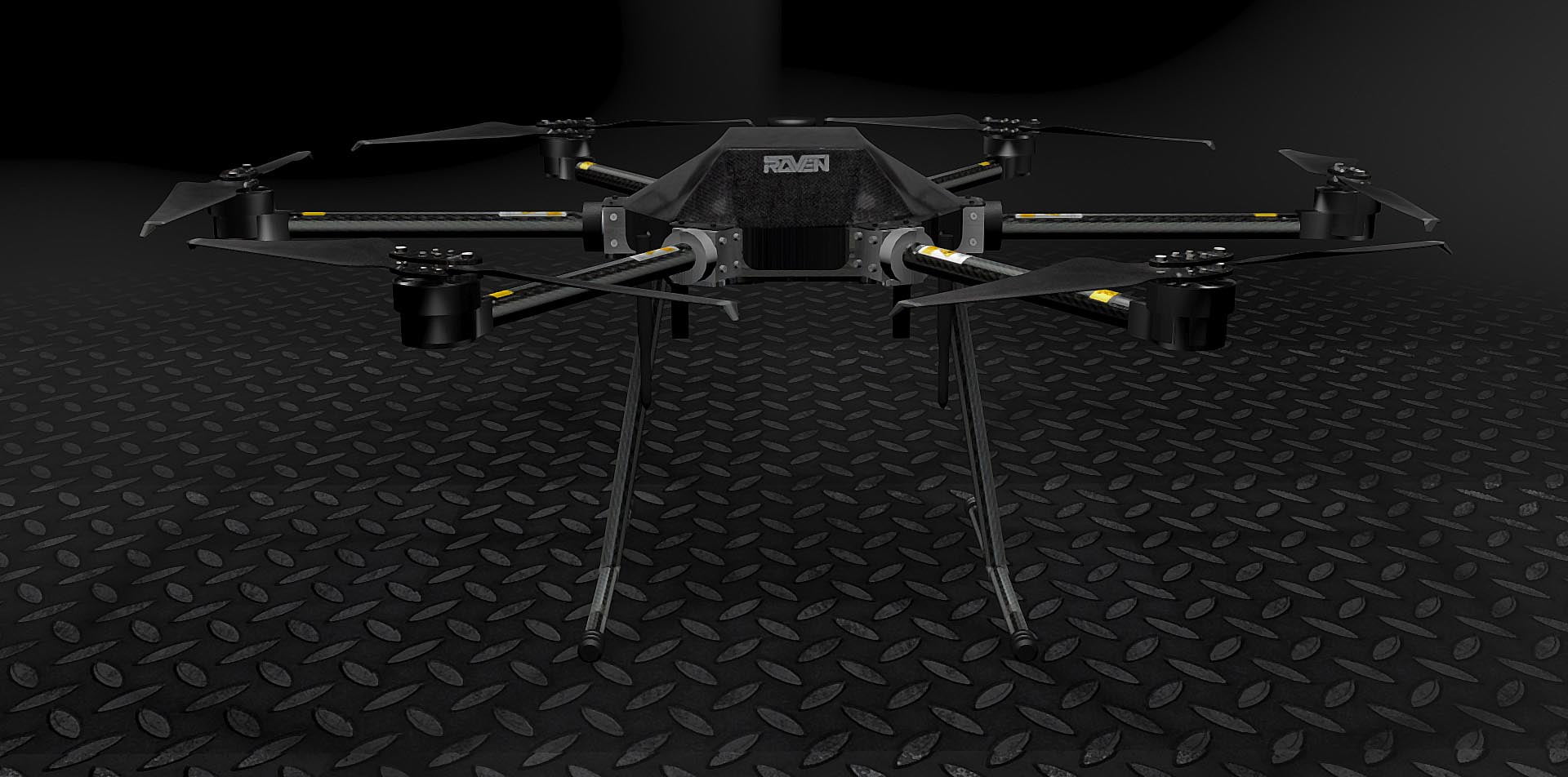
RAVEN
Teknoloji
Endüstriyel görevlerde kullanılacak, müşteri için özelleştirilmiş hava araçları geliştiriyoruz. Arama kurtarma drone ları, yangın söndürme, tarım uygulamaları, termal kameralı İHA modeller ile endüstriye özel çözümler sunuyoruz.
Teknoloji
Endüstriyel görevlerde kullanılacak, müşteri için özelleştirilmiş hava araçları geliştiriyoruz. Arama kurtarma drone ları, yangın söndürme, tarım uygulamaları, termal kameralı İHA modeller ile endüstriye özel çözümler sunuyoruz.
Uygulama Alanları
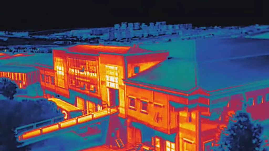
İHA’LAR ILE DENETLEME, ANALIZ VE GÖRÜNTÜLEME
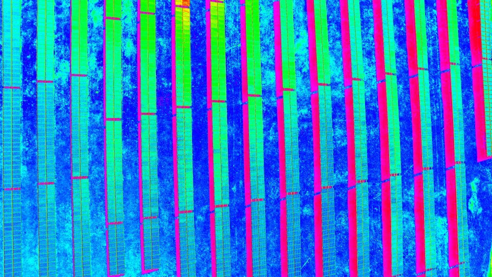
Rüzgar türbini ve güneş panelleri tarlaları, elektrik ve petrol nakil hatları, tren rayları, uçak ve gemi gövdelerinin İHA tabanlı analizi ve denetimi
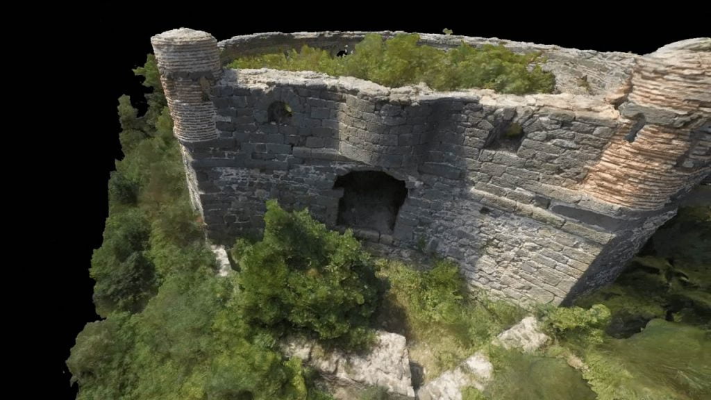
İHA TABANLI HAVADAN GÖRÜNTÜLEME SISTEMLERI
Çok Rotorlu İHA’lar yardımı ile elde edilen yüksek çözünürlüklü fotoğraf ve videolar hem profesyonel hem amatörler için yeni ve eşsiz bir kabiliyet sunuyor.
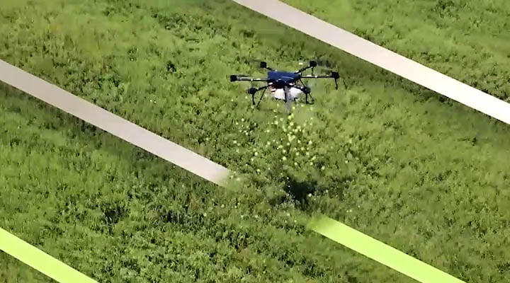
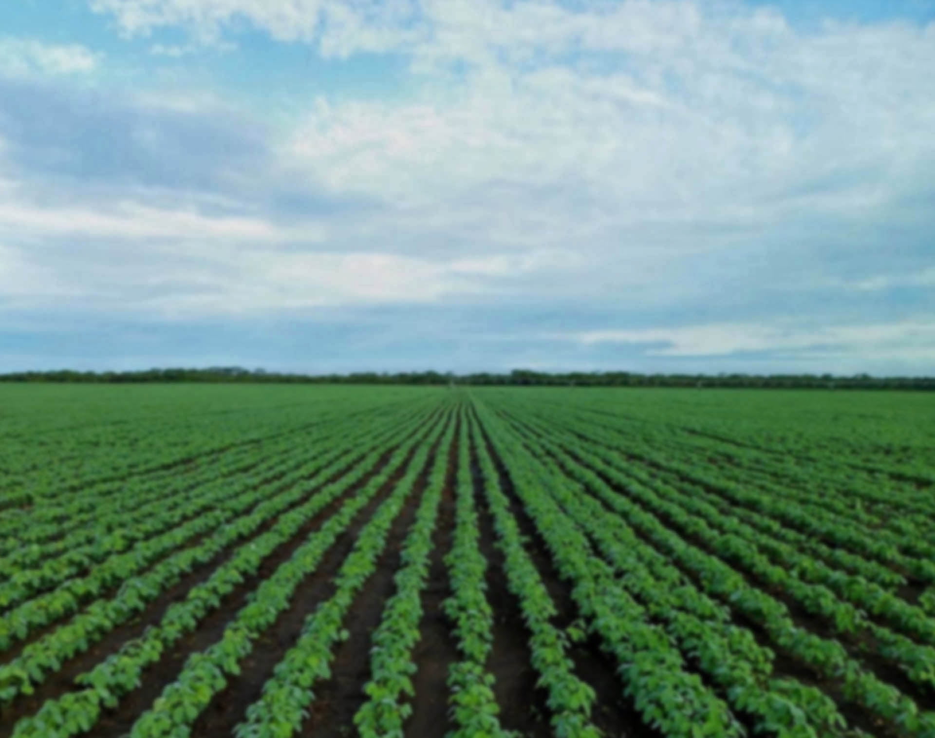
TARIMDA İHA’LAR ILE MAHSÜL ANALIZI
Ekin ve mahsüllerin havadan verim-hastalık-olgunlaşma analizinin yapılması; bu verilere göre hasat ve nadas kararı alınmasını sağlanması ve bilimsel tarım yaklaşımı uygulamaları.
İHA’LAR ILE KARGO TAŞIMA VE YÜK BIRAKMA
Ultra-hızlı paket teslimatı ve gerekli koordinatlara acil yardım malzemeleri, yangına müdahale ekipmanları gibi kritik faydalı yüklerin havadan bırakılması.
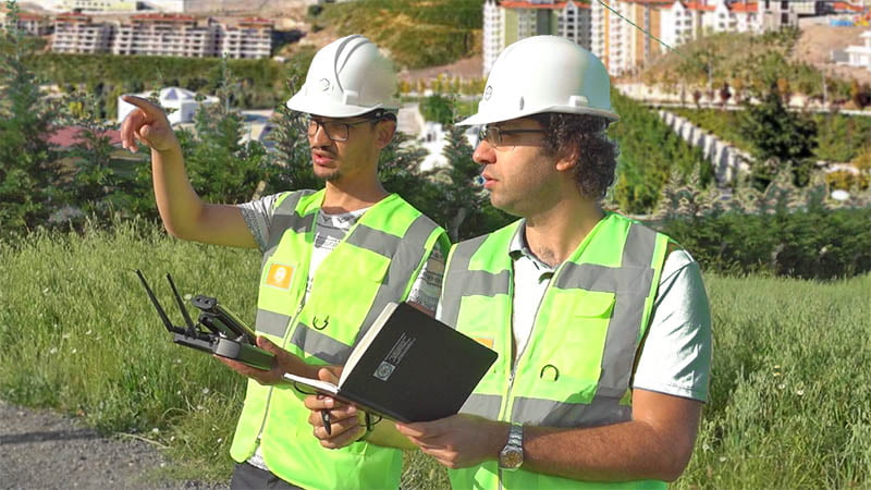
YAPI SEKTÖRÜNDE İHA’LAR
Şantiyelerde inşaat malzemelerinin hassas stok durumu tespiti ve yapının yükselme sürecinin kaydedilerek görüntülenmesini mümkün kılar. İskele, vinç ya da helikopter gibi pahalı ve operasyonu riskli süreçlere ihtiyaç azalır.
İHA’LAR ILE ARAZI ETÜDÜ VE HARITALAMA
Gelişmiş Oto-pilot sistemi sayesinde haritalama ve arazi analizini halihazırdaki yöntemlere göre 4’te 1 sürede ve çok daha yüksek hassasiyetle yapabilirsiniz.